12 May 2022
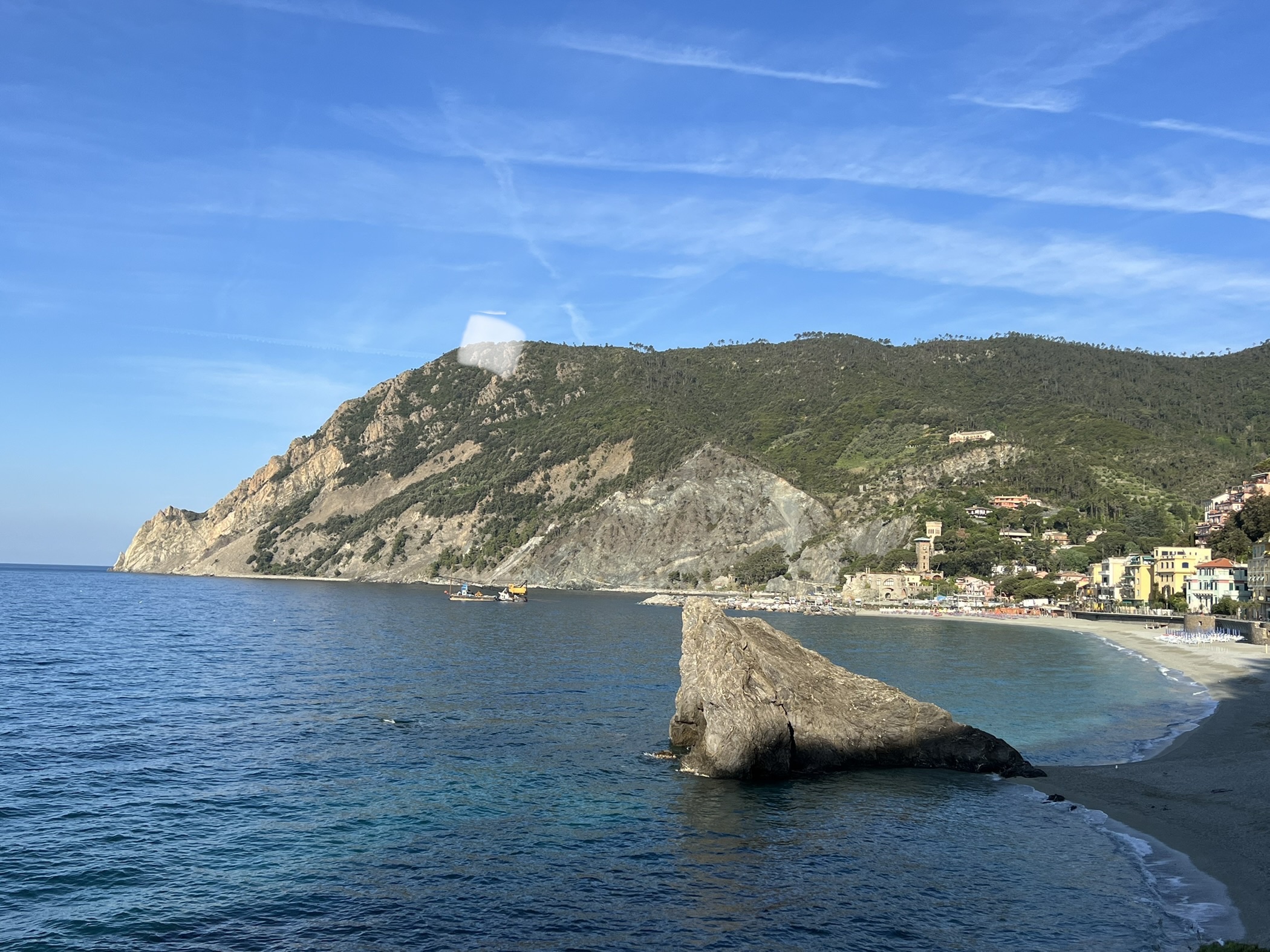
On a clear day, there is no panoramic point on the Cinque Terre that equals Punta Mesco, a promontory to the west dividing the village of Monterosso al mare from that of Levanto. From Monterosso, the promontory is very appealing, but hiking to this massive rock formation is daunting. I read that Italian poet Eugenio Montale walked here as a youth, later in 1975 he was awarded a Nobel Prize in Literature. Don’t know about his poetry but the fact he walked this trail more than once should have earned him a Nobel Prize for something!
This morning I started out at 7:53 and it was already warm. The walk just to the entry of the trail is a good 10 minutes from old town, past the train station and Gigante holding up a villa’s rock. Then I began to climb. At first, it was an interchange between steps and ramps before I exited onto a paved road. The road is for the benefit of the very expensive villas and hotels, not the hikers. That fact becomes clear when I arrive at the steps.
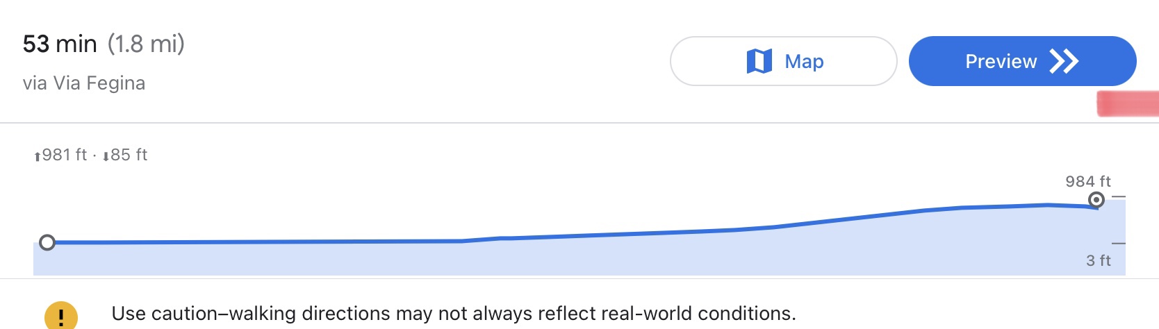
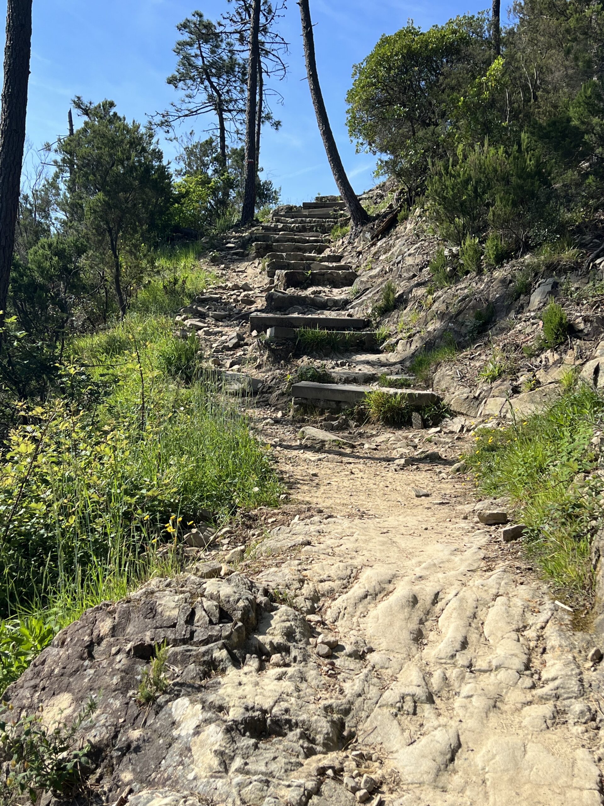
The trail isn’t really well marked, possibly because the villas do not want red and white stripes on their rocks. At the hotel, the stairs begin a serious vertical climb to about 984 feet above sea level. That’s a long way up!
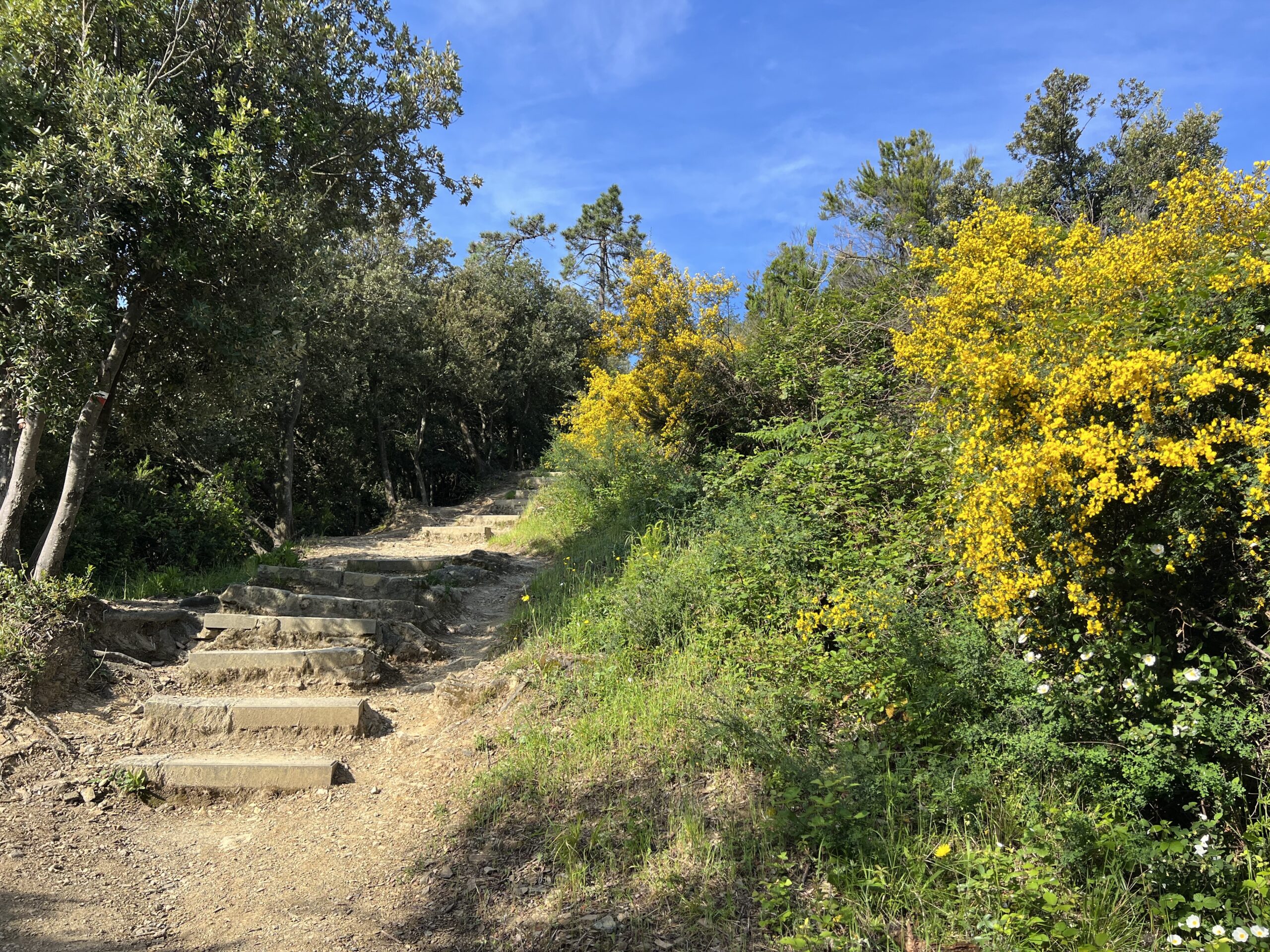
I am in the shade of pines and oaks, the Genisteae or yellow gorse is in full bloom and always there is the fragrance of the citrus produced by an abundance of what I think is Pittosporum or mock orange.
Early on, I met a couple of bikers who were planning to hike to Levanto, rent bikes and ride back to Monterosso. One must scale the mountain then hike an additional 4 miles or so. No thanks. After I have hiked just a fraction of this trail, I suspect the bikers may be on the trail for some time.
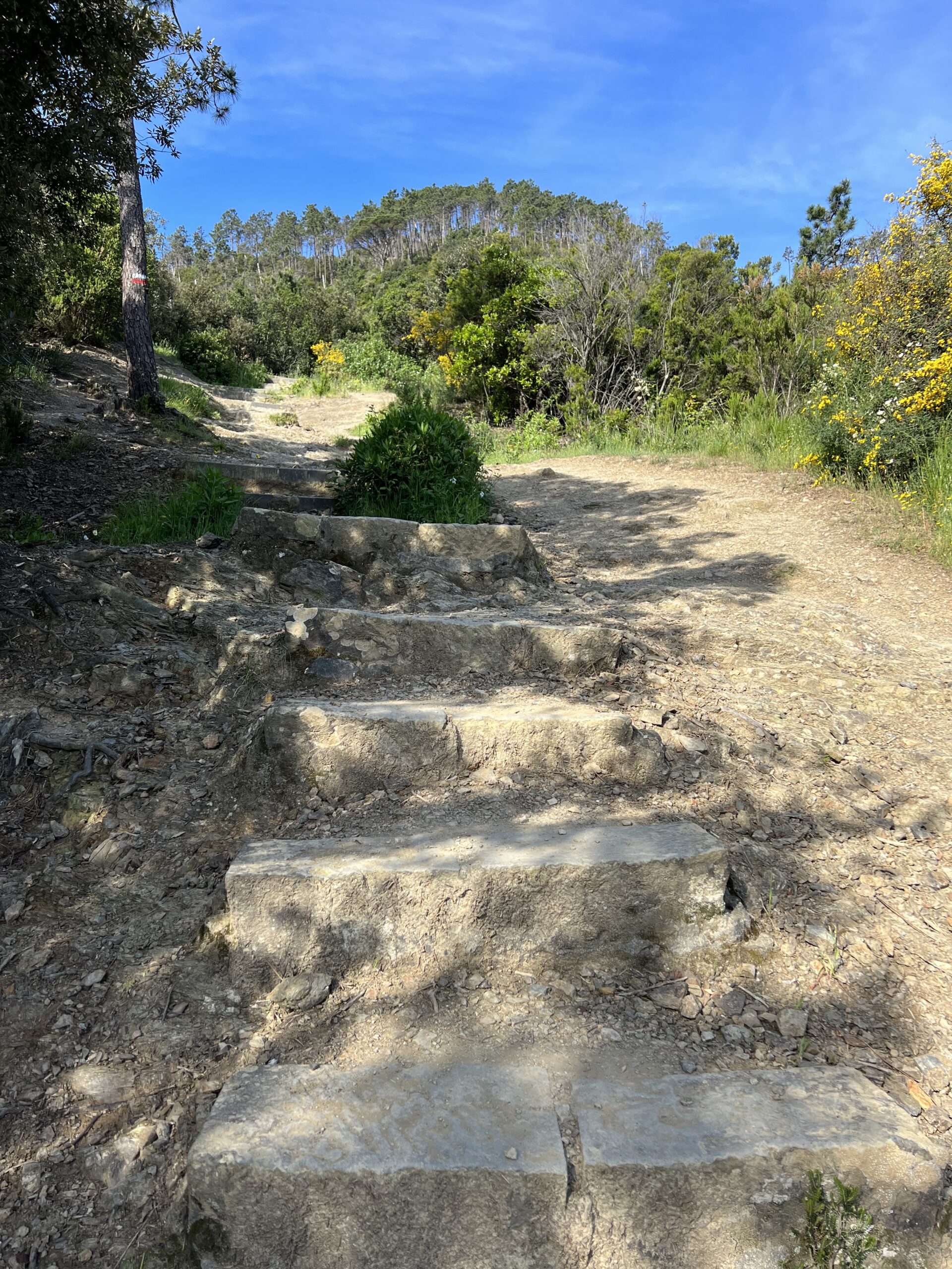
The so-called stairs are mixed with eroded gravel paths and what passes for rock steps. The trail is crude, undeveloped rock that is uneven and inconsistent. Excluding the trail climbing out of Riomaggiore by Via Becerra to Manarola, this trail is probably the most undeveloped one I have hiked. So far, the chaparral and trees provide shade but also block most views.

This is a god-awful trail. There are steps where I literally stand to contemplate how I want to challenge them. I found if I place one foot on the dirt trail and then the next upon the step, it’s less of a push and I’m able to do a few stairs at a time rather than right, right, right, right, left, left, left, left – ad nausium.
I keep gasping “I have to be almost at the top.” I check Google Maps and it tells me I have 98 meters to go. At times like this I like to look at meters and not translate into 300+ feet of elevation – 98 meters just sounds shorter. Either way, I have a lot more rocks to climb. Whenever I can, I use the little side rocky paths to avoid climbing up 10 or 15 more uneven stairs.
The yellow gorse is in full bloom and quite beautiful contrasted against the blue sky and the pines. I can see a single fringe of trees that follows the ridge line of the mountains. It resembles a Razorback’s hair sticking up on end. Occasionally a small lizard scampers across the rocks and into the brush. No Vipers! All is quiet and I am alone on the trail.
I stop to gasp, sip water. Some steps are better used as benches. Google maps foretells nothing but meters of rocks in my future. It says three minutes to the sanctuary. I walk up what is really a watershed rock bed and I don’t even want to think about what it is going to be like to return down this trail.
I do see footprints in the sand but they may be left from the Neanderthal age. I see no people.
I don’t see the sanctuary that is supposed to be here. The trail alternates between what looks like steps and rocky dirt. I am basically climbing up rocks and taking the easiest way possible. The occasional red and white stripes indicate I am on a path, I assume the right one. Finally, I break out of the trees and feel the cooling updraft of the sea breeze.
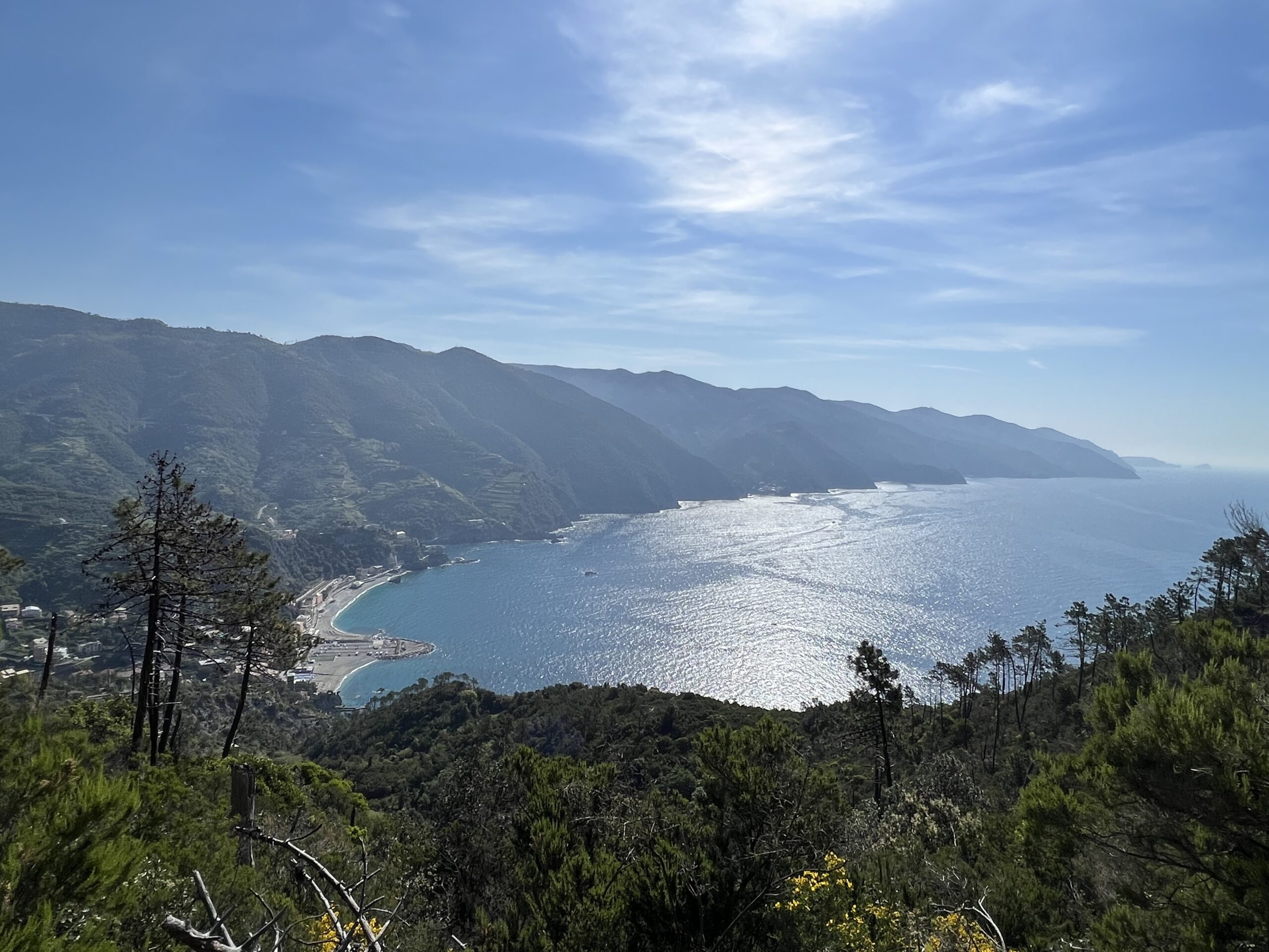
The view is spectacular! Below is all of Monterosso. The sea is alive with boats. I can see Vernazza, and although hazy, Cornelia sits atop its rocky promontory, then beyond is Manarola, and really distant in the haze is Riomaggiore. It is possible to see the Isola del Tino and the island of Park Porto Venere jutting off the very southern end of the Cinque Terre coastline.
Enjoying this fantastic view, I’m stunned by a young man who just jogged by, going up! He even had enough breath to greet me. “Buon giorno,” he says. What a show off!
I reached the ruins of Chapel of St. Antonio and the old lighthouse about 10 AM.
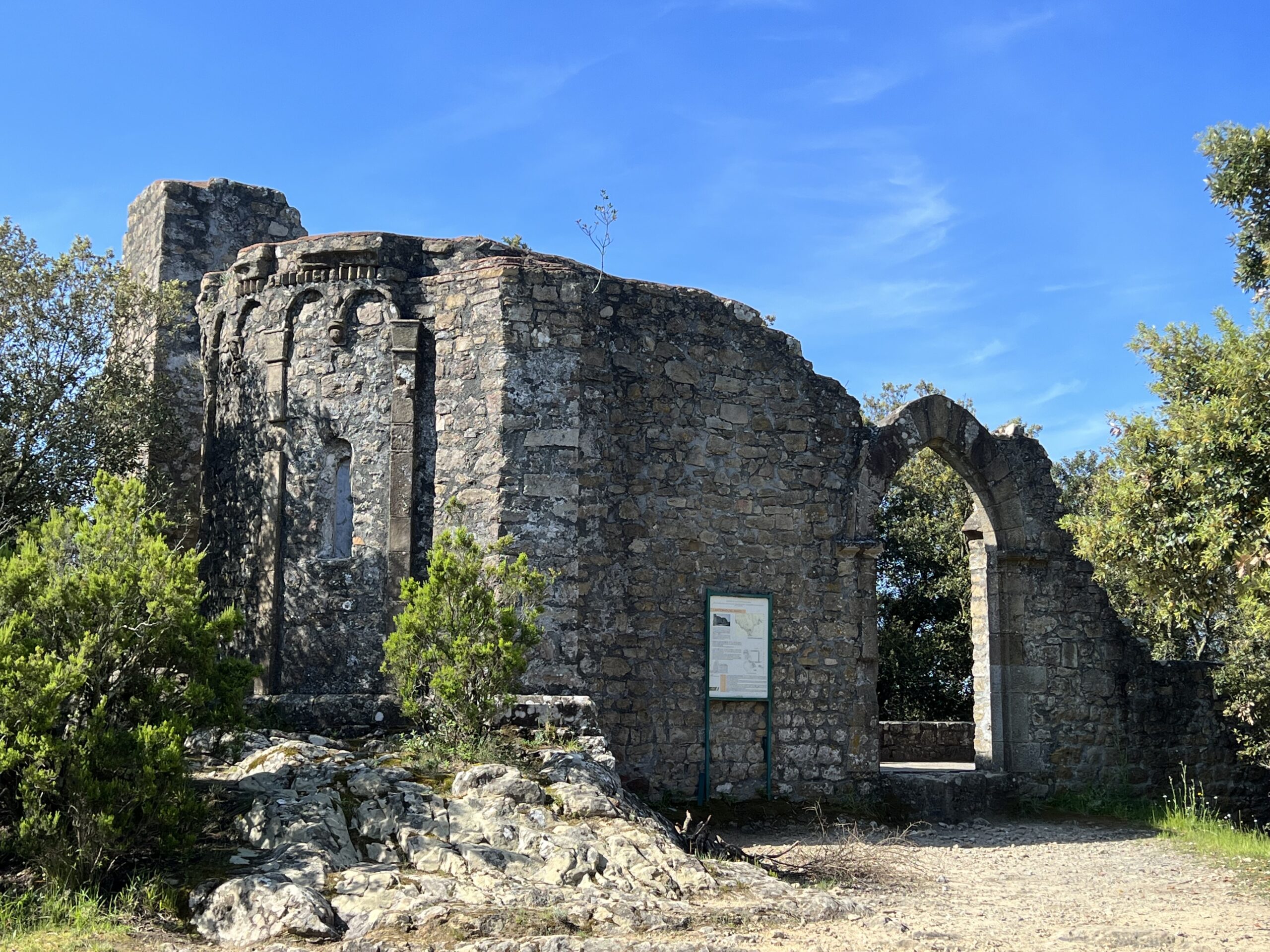
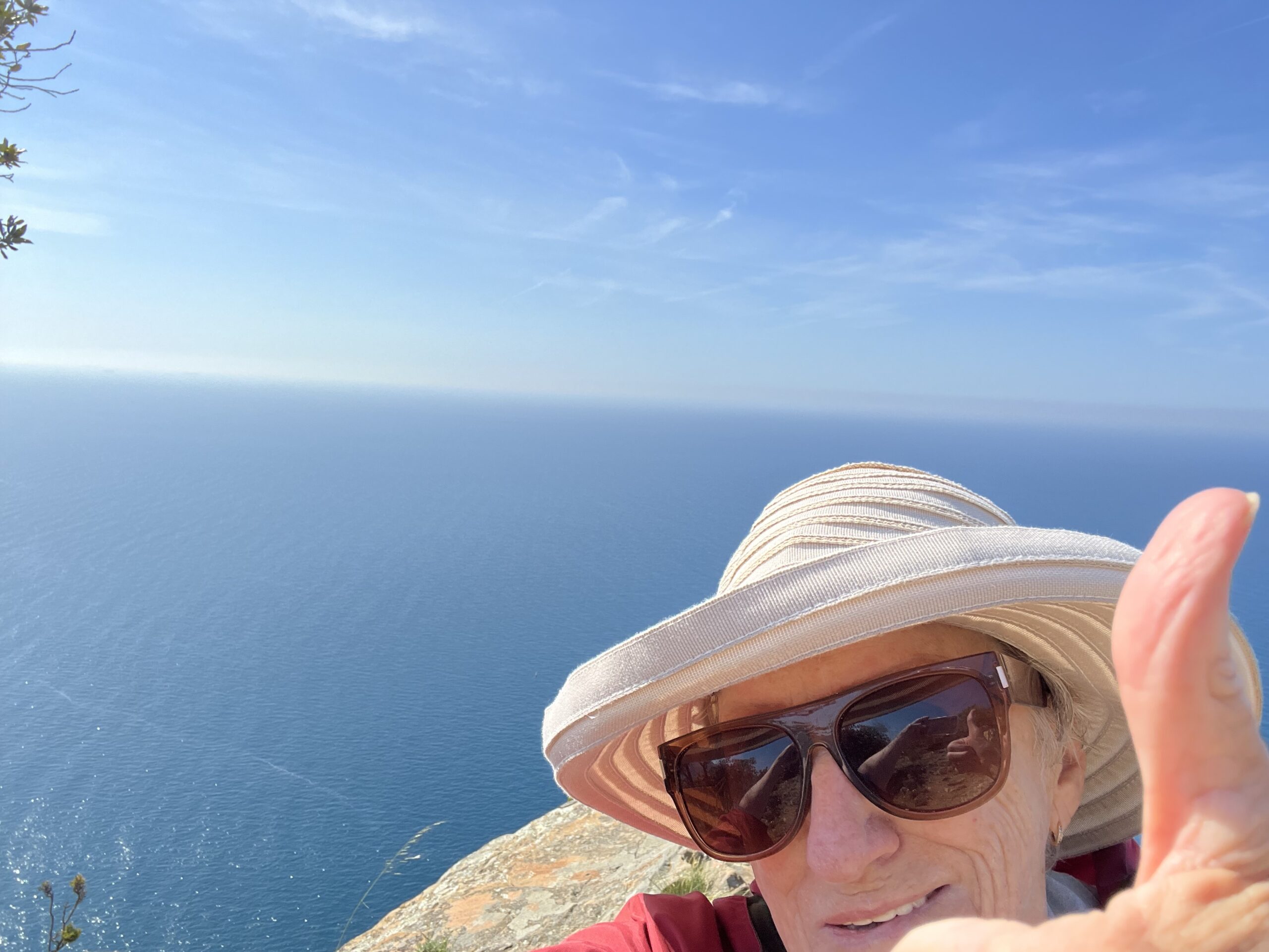
The ruins of the Chapel are picturesque. The medieval hermitage may date to as early as the 11th century. There appears to be a row of north facing bunkers below. The old lighthouse and other deserted concrete buildings are weathering away except for some artistic graffiti. Walking around the lighthouse I come to the final rocky point, a rather dangerous spot where everything around you is in the direction of down. Of course this warrants a cautionary photo and rest. I figure if I roll off the precipice, the pain will be short-lived compared to hiking down the mountain.
My downward journey is lightened as I meet a young Swedish mother who has hiked up: wearing sandals and carrying “my 8-kilo daughter.” It puts my plight into perspective. And she kindly offers me water. I’m not in need as yet so decline. I am thinking she wants to lighten her load and am thankful she hasn’t offered me the baby.
I finish my peanuts, drink my water and face this god-awful trail, hoping to avoid slipping and sliding back. Google Maps, obviously designed for the young and fit, says I should be able to be at Gigante in 30 minutes. Me thinks it lies: maps also said it was 53 minutes to the top! I estimate I was scaling step 700 with a million to go after 53 minutes.
The path down goes faster of course; I pass a large group of Swedes chatting away as they hiked upward. Bless their hearts. My hiking boots, strapped together with their own laces something like a crocodile’s mouth, have held together to get me through this worst of the trails of the Cinque Terre. They have met the challenge, sometimes facing the next step less as a stair and more as a leap of faith.
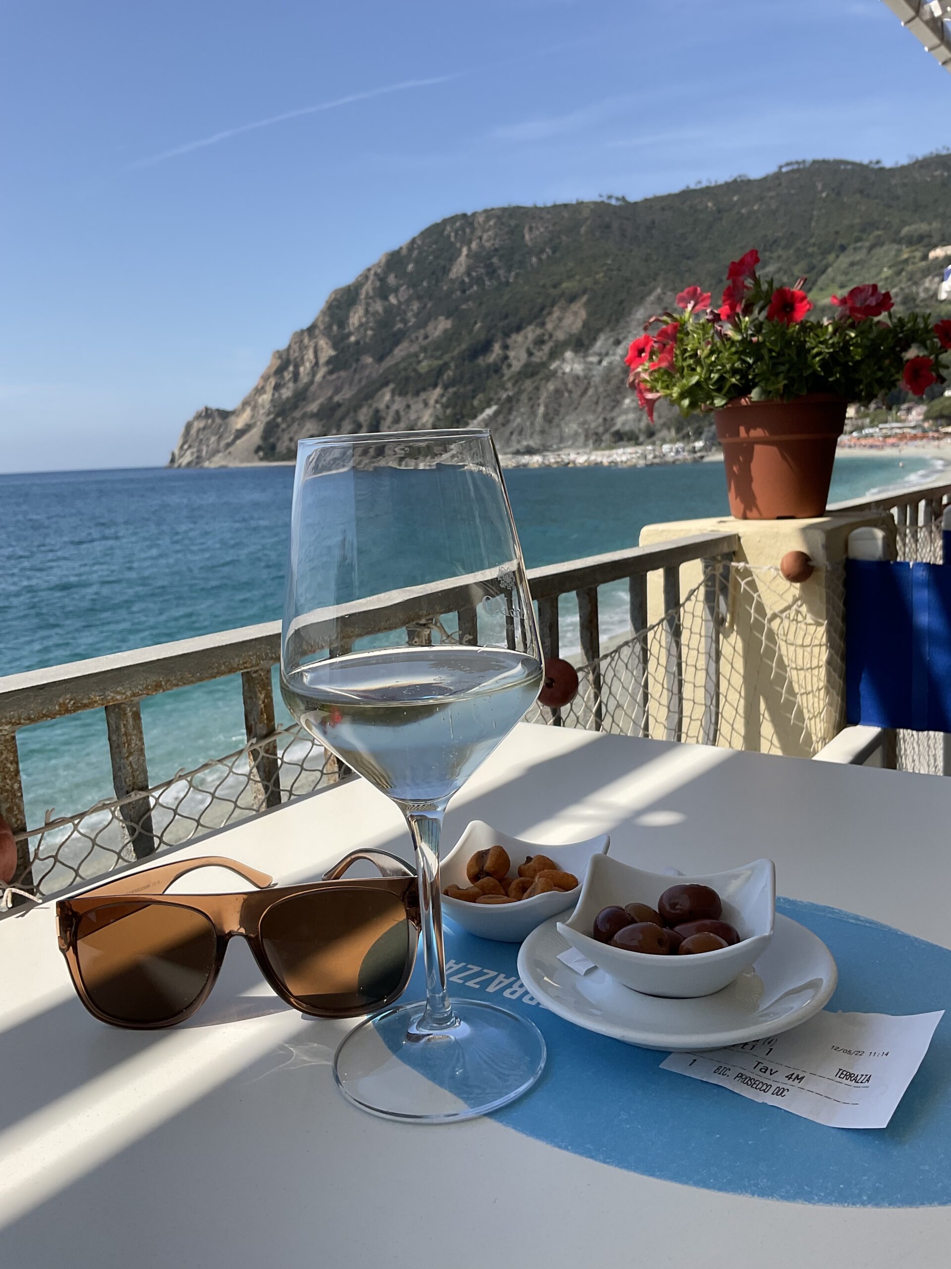
In 30 minutes I reach the road. Then it becomes a cakewalk. Arriving In Monterosso 15 minutes later, I pass the Eugenio Montale Park (bless his literary heart) and stop at La Terrazza for a well-earned cold Prosecco and brochetta. Actually, two Prosecco. My table overlooks the promontory of Punta Mesco, such an innocent beauty at the end of the bay. But, I know it’s secrets.
I contemplate the moment, about three weeks ago, when I was picking myself up from the middle of a street with what I became to suspect as a ruptured disc. I was in pain; ibuprofen became a close friend. The following Monday morning, about to fly to Italy, limping and aching, I couldn’t help but wonder what in the hell was I thinking. I boarded that plane; I refused to cancel my Cinque Terre travel for a third time (first two Covid induced).
I guess, I’m thinking, I’m gonna die somewhere and I’ve seen some fantastic views that certainly beat the view from the middle of a street at home. With this, I make a toast to Punta Mesco and the remains of my hiking boots, finish my Prosecco, and head back to my room for a long hot shower.
I have earned it all.
0 Comments