19-20 September
The Georgian Military Highway wears an ominous name but, presently, is a scenic route that has linked Europe and Asia for centuries: seventy-five miles of twists and turns, sparkling lakes, waterfalls, mountain peaks, passes and stomach churning edges. I am expertly driven north along the historic Georgian Military Road which weaves from Tbilisi to Vladikavkaz, Russia. Traditionally the route of invaders and merchants, it now sees the passage of more skiers and tourists than conquering hoards.
In spite of its history of accommodating armies of invasion for centuries, the 125-mile route was renamed “military” in more recent times, after Russia annexed Georgia to its territory in the early 19th century. And to this day, the area of South Ossetia is hotly debated as Russian military continue to occupy territories of Georgia. Over 20 Russian military bases are within 40 miles of Tbilisi and a Russian fortified border lies just a few miles west of the quite aptly named Military Road.
All the cited laws and bickering back and forth gained new meaning after the Russian invasion of the Crimea in 2014. For Georgians, South Ossetia and Abkhazia remain occupied territories. Russia claims sound familiar, that “Abkhazia and South Ossetia are not occupied territories, but independent States.” In 2013 Russia asked Georgia to abolish the law concerning the occupied territories claiming that its abolition would “create a favorable environment for cultural exchanges, above all for tourist trips.” Or, considering Russia’s track record of suppression, perhaps not.
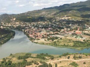
Our first stop of the day is just 14 miles north of Tbilisi at Mtskheta (UNESCO), the ancient capital of eastern Georgia. The city was founded as early as the 5th century BC, tucked into a river bend where a brown Mtkvari River and the blue waters of the Aragvi River meet. Georgia’s conversion to Christianity occurred in 337 AD in Mtskheta, which was declared as a “Holy City” by the Georgian Orthodox Church in 2014. Even after the capital was moved to Tbilisi in the 6th century, Mtskheta continued to serve as the coronation and burial place for most kings of Georgia until the 19th century.
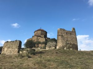
The Church and Monastery of Jvari, or “Monastery of the Cross, (UNESCO) perches high on a rocky clifftop with magnificent views overlooking Mtskheta and the confluence of the rivers to the west. Dating from 590 AD, this Georgian Orthodox Church is in the “tetraconch” style, meaning a church built with four apses, one in each direction and usually of equal size creating a basic ground plan of a Greek cross. According to tradition, on this commanding location in the early 4th century, the female evangelist Saint Nino, who converted the King of Iberia to Christianity, erected a huge wooden cross over a pagan temple. The cross was reportedly able to work miracles and drew pilgrims from all over the Caucasus. The Small Church of Jvari was erected over the remnants of the wooden cross in 545. Today’s Great Church of Jvari replaced that structure in 590.
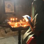 The interior of the church is impressive because it is just ancient and simple with an amazing, lofty stone dome. The small windows admit just enough light to highlight the 30’ foot wooden cross under the dome. The frescoes are dark and partially destroyed (again the work of invaders and Russians) but we learn that the goal is to conserve these beautiful frescos and not restore them as the belief is that restoration destroys their value. Instead, the frescoes slowly deteriorate from light and smoke. Carved bas-relief sculptures adorn the outer walls.
But the true star of this stopover is the view. The river confluence, mountains, valley, village, blue sky and miles and miles of spectacular landscape lie below me.
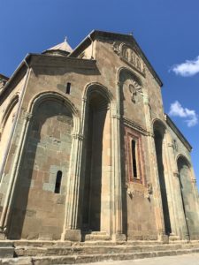
And about 2000 feet below, nestled in the bend of the two rivers is the Sventi-Tskhoveli Cathedral, “Cathedral of the Living Pillar” (UNESCO), the first Christian church to be built in Georgia and second largest building in Georgia. The original church was built in the 4th century, its location chosen by Saint Nino herself. What Jvari has in simplicity, the Svetitskhoveli makes up for a thousand-times over.
Svetitskhoveli is among the most venerated places of worship in Georgia and known as the burial site of Christ’s mantle. Supposedly, in the 1st century AD, a Georgian Jew named Elias from Mtskheta was visiting Jerusalem when Jesus was crucified. Elias bought Jesus’ robe from a Roman soldier at Golgotha and brought it back as a “souvenir.” Unfortunately, when his sister Sidonia touched the robe, she died and the robe could not be removed from her grasp so she was buried with it. The place where Sidonia is buried with Christ’s robe is preserved in the Cathedral.
The legend continued when a cedar tree grew out of the grave. Saint Nino had 7 columns carved from the tree for the church’s foundation. A seventh column magically arose into the air only returning after much prayer from St. Nino. This magical seventh column thenceforth produced a sacred liquid that cured people of all diseases. Faith is a powerful thing.
 The present church was completed in 1029 and the exterior façade is an attractive mix of green, red and ochre shades. Many of its frescoes were destroyed when the Russians whitewashed over them, the ones remaining are breathtaking. Stone bas-reliefs and columns adorn the large interior, though I am not sure what the bulls’ heads symbolize. A small 14th century shrine is sculpted as a replica of the Church of the Holy Sepulchre.
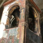
Not only were Georgian kings crowned here but there are numerous tombs about the church in which they are buried. At least ten are recorded as buried here, including the last king of Georgia, George XII. The 17th century canopy, under which the robe of Jesus is said to be buried, is beautifully unique.
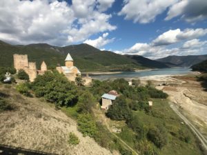
Just 28 miles further north is the 16th century fortress of Ananuri. Built by the warring dukes of Aragvi in an attempt to control the main north-south route of both invasion and trade. This was long before construction of the Zhinvali Dam which created the enormous Zhinvali Reservoir.
Above its southern shore is the Ananuri Fortress and church (UNESCO). The feudal dynasty of the Aragvi ruled the area beginning in the 13th century and defended their castle against several invasions (unfortunately failed against the invasion of trinket-and-Russian-hat salesmen). But luck ran out in 1739 when attacked by a rival and Fortress Ananuri was burned and the Aragvi family massacred. This rival’s success was not to be enjoyed for long as four years later, peasants revolted, killed the usurpers and invited another king to the throne. This cycle of unrest continued with the fortress remaining in use until the early 19th century.
The fortress consists of two castles joined by crenellated walls. A large square tower is well preserved and was used as a place of last defense. The lower fortification, with a round tower, is mostly in ruins. But again, the views of its surroundings are spectacular.
Within the complex are two churches. The older brick Church of the Virgin with its square tower, holds the tombs of the Aragvi family. It dates from the first half of the 17th century. The interior is unadorn, but a stone canopy erected in 1674 is nice.
The larger Church of the Mother of God was constructed in 1689. Its façade is ornately carved with florals, saints, a grapevine cross, and inscriptions. The church consists of a central dome and a few frescoes which survived a devastating fire in the 18th century.
I can walk out onto the road’s bridge above the gigantic Zhinvali Reservoir for some great photos. The environs are rugged and beautiful, weather perfect, sun blasting down. It is a great spot for a fortress.
Even though The Military Road continues along the east side of the watershed and another 80 miles to Vladikavkaz, we depart the road, after much twisting and churning, for our overnight stay at Gudauri, a popular ski resort. We rest at over 7,100 feet, surrounded by the towering peaks of the Greater Caucasus.
We sleep for the next two nights at the Marco Polo, one of the best hotels in Gudauri. The contemporary facilities offer everything from gym, spa and pool to tennis courts. Its three bars with views help soften the impact that just a few yards away is the busy Military Highway, a gas station, a Dunkin’ Donuts mini mart and not much else. But near the donuts are shelves of inexpensive vodka, wine and two-liter bottles of beer for little more that $2. The can of Pringles would cost more. The mountainsides are literally covered in ski runs and over a glass of Georgian beer, I think how nice it would be to descend one of those slopes come December. I am told an all-day pass costs about $16! One can probably fly here and ski for a week for less than it costs for a weekend in Mammoth or Tahoe.
The next morning, with the chill of winter in the air and finally a use for the turtleneck I am packing, our driver continues to weave his way through alpine meadows and mountain passes just 27 miles north to Darial Gorge. Least we forget what this road represents, tall stone watchtowers spot the passes and mountainsides.
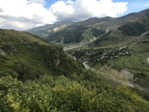
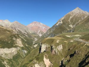 This well-maintained, two-lane road is the most beautiful mountain scenery in Georgia. Tree lined to about 7,000 feet, the mountainsides transform into smooth, velvety grass meadows supporting local flocks of sheep and cattle. Further in height, the mountains become a plethora of pastels: pinks, greens, purple, orange and golds before the grays and streaks of white. The topmost, highest peaks are draped with glaciers of white snow. And above it all a cloudless, blue sky.
We stop for an opportunity to visit the site of a German grave yard at the 7,900 ft. pass. Though no Germans ever invaded Georgian territories during WWII, this area was used for the internment of captured German soldiers. It was these soldiers who built the rock and concrete tunnels along this section of the pass so that passage was possible during the winter. Many soldiers remain buried at the top of the pass.
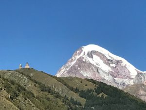
Above the small village of Gergeti our next destination is perched high above us atop a mountain peak. We move into four-wheel drive vehicles for the steep, rock and tree littered winding road up to the Tsminda Sameba Monastery and beautiful Gergeti Trinity Church, a 14th century edifice built on the right bank of the Chkheri River at an elevation of over 7,200 ft. The surrounding scenery is spectacular with snow-topped Mount Kazbek, an extinct volcano and the tallest mountain in Georgia at 16,500 ft.,directly in front of me.
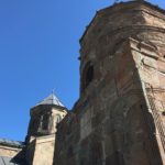 The stone church was built in the 14th century and is a cross-cupola design. Its separate bell tower dates from the same century. This was a place of refuge for many priceless religious relics, especially during the Soviet regime. The church is currently an active Georgian Orthodox Church. Its mountaintop location surrounded by the vastness of nature has made it a symbol of Georgia and a place of respect and contemplation for anyone energetic enough to climb the steep trail from the village of Gergeti. I can just as well contemplate after our 30-minute auto climb. Let Toyota do the work and let me enjoy this incredible vista.
As with almost all churches I have visited, the frescoes are dark and deteriorating, the icons bright and fairly new (post-Russian independence). The church itself is small and the resident monks protect what they have. And the best thing they have are the fantastic views!
After lunch, we continue further north. The sky is blue, there is the sprinkling of puffy clouds, and the breeze is warm and soft.
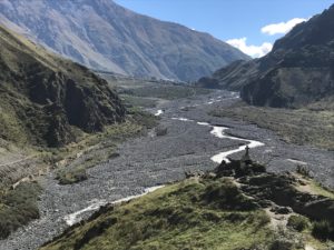
We navigate the gorge, a huge 9-mile gash in the earth that has been carved out by the mountain waters of the Terek River. Steep granite walls look insurmountable. It is thought that Alexander the Great “slept here” and built iron gates at the pass. But the biggest importance for the Darial Pass is that it represents one of only two crossings of the Caucasus mountains range. Thus, its fortification since before 150 BC. Ruins of watchtowers and walls can still be seen and Russia’s Border Crossing is just a couple miles north. Russian Fort Darial was built at over 4700 ft. and even in mid-September, this assignment would be cold, windy and unappealing.
 The gorge is vividly described in Lermontov’s 1829 Russian poem, “The Demon,” making this site one of the most romantic places in the Caucasus. To paraphrase one interpretation: It opens with the “protagonist wandering the earth, hopeless and troubled. He dwells in infinite isolation, his immortality and unlimited power a worthless burden. Then he spies the beautiful Georgian Princess Tamara, dancing for her wedding, and in the desert of his soul wells an indescribable emotion. The Demon, acting as a brutal and powerful tyrant, destroys his rival: at his instigation, robbers come to despoil the wedding and kill Tamara’s betrothed. The Demon courts Tamara, and Tamara knows fear, yet in him she sees not a demon nor an angel but a tortured soul. Eventually she yields to his embrace, but his kiss is fatal. And though she is taken to Heaven, the Demon is left again ‘Alone in all the universe, Abandoned, without love or hope!…’“
 The views of the gorge are impressive. I am bracketed by Mount Kazbek at 16,500 feet and 14,603 ft. Mt. Shani to the east. Below, the broad rocky river beds continue to carve out the gorge. Certainly a perfect spot if one seeks “infinite isolation.”
There are countless picturesque viewpoints along the Military Road and one cannot stop at them all. However, the Soviet-Georgian Friendship Memorial just 4 miles north of Gudauri is worth a few moments. One can only hope friendly relations remain. As our half Russian/half Georgian guide points out, “we are culturally connected but have totally opposite views when it comes to politics and governance.”
The monument is of stone and overlooks the Devil’s Valley (a rather ironic placement). The site is high above the river gorge, overlooking waterfalls, mountain peaks, colorful soaring para gliders, and the vastness of nature. The circular walls of the interior of the monument are decorated with colorful tile murals depicting Georgian and Russian history. It was built in 1983 to celebrate the bicentennial of the 1783 Treaty of Georgievsk and the “ongoing friendship” between Georgia and Soviet Russia.
One wonders how much the Georgians celebrated this treaty as it established eastern Georgia as a protectorate of Russia. And we know from reading our history books, such agreements with the “Big Bear to the North” did not always go well.

0 Comments